


ZERBE TWP DIST WEST, Northumberland County, Pennsylvania
About
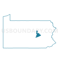
Outline

Summary
| Unique Area Identifier | 661864 |
| Name | ZERBE TWP DIST WEST |
| County | Northumberland County |
| State | Pennsylvania |
| Area (square miles) | 4.58 |
| Land Area (square miles) | 4.57 |
| Water Area (square miles) | 0.01 |
| % of Land Area | 99.87 |
| % of Water Area | 0.13 |
| Latitude of the Internal Point | 40.77286870 |
| Longtitude of the Internal Point | -76.69008020 |
Maps


Graphs
Select a template below for downloading or customizing gragh for ZERBE TWP DIST WEST, Northumberland County, Pennsylvania


Neighbors
Neighoring Voting District (by Name) Neighboring Voting District on the Map
- LITTLE MAHANOY TWP VOTING DISTRICT, Northumberland County, PA
- ROCKEFELLER TWP VOTING DISTRICT, Northumberland County, PA
- SHAMOKIN TWP VOTING DISTRICT, Northumberland County, PA
- WEST CAMERON TWP VOTING DISTRICT, Northumberland County, PA
- ZERBE TWP DIST EAST, Northumberland County, PA
Top 10 Neighboring County Subdivision (by Population) Neighboring County Subdivision on the Map
- Shamokin township, Northumberland County, PA (2,407)
- Rockefeller township, Northumberland County, PA (2,273)
- Zerbe township, Northumberland County, PA (1,872)
- West Cameron township, Northumberland County, PA (541)
- Little Mahanoy township, Northumberland County, PA (479)
Top 10 Neighboring Place (by Population) Neighboring Place on the Map
Top 10 Neighboring Unified School District (by Population) Neighboring Unified School District on the Map
- Shikellamy School District, PA (22,592)
- Shamokin Area School District, PA (20,912)
- Line Mountain School District, PA (9,200)
Top 10 Neighboring State Legislative District Lower Chamber (by Population) Neighboring State Legislative District Lower Chamber on the Map
Top 10 Neighboring State Legislative District Upper Chamber (by Population) Neighboring State Legislative District Upper Chamber on the Map
Top 10 Neighboring 111th Congressional District (by Population) Neighboring 111th Congressional District on the Map
Top 10 Neighboring Census Tract (by Population) Neighboring Census Tract on the Map
- Census Tract 808, Northumberland County, PA (7,067)
- Census Tract 819, Northumberland County, PA (5,923)
- Census Tract 818, Northumberland County, PA (3,640)